City Churer Rheintal
Tamins


Show all 5 images

Description
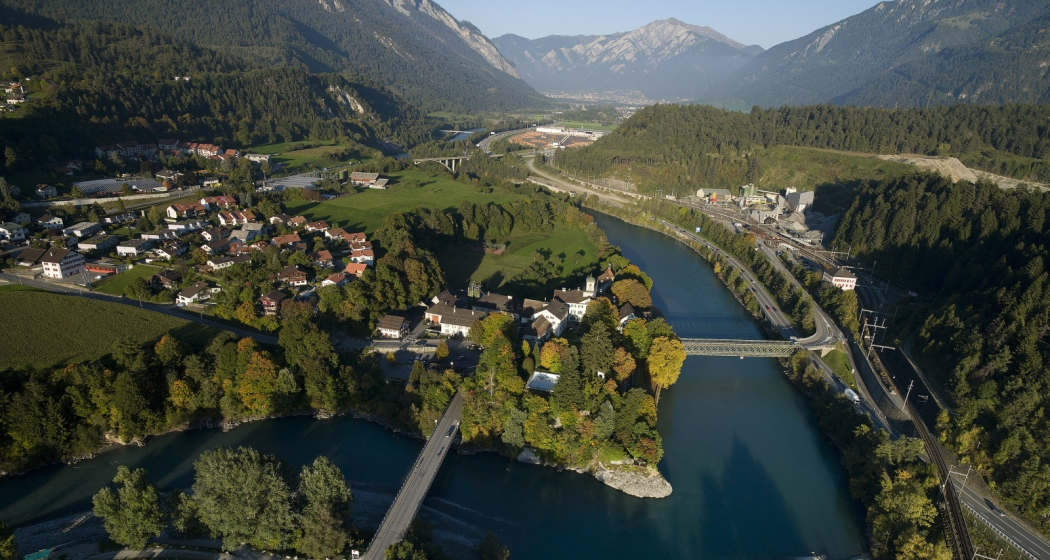
The uniquely sunny location makes Reichenau and Tamins a fantastic place to live. Inhabitants profit from a well-developed infrastructure and modern school facilities. Locals and tourists alike find excellent public transport links. Tamins is located along the main north-to-south traffic axis, the A13 motorway.
The natural landscape around Tamins is one of a kind, with many hiking trails through forests and meadows and a diverse flora and fauna. The diversity of nature's beauty knows no bounds in this wonderful area. The unique oak forest, the adjacent rough pastures and the dry landscapes are of national importance. The natural reserve Rattena is characterised by its species-rich hedges, old deciduous trees, dry walls and reptile habitats, ponds and the Valtonis creek. The adjacent forests also have an impressive biodiversity. More than 20 different species of deciduous trees can be found here, amongst them some "exotic" species like the downy oak and the chestnut tree. The entire area is integrated into the Eichwald forest reserve. An exciting nature learning trail introduces visitors to the beauty and the inner workings of this unique landscape.
Where earth meets the skies, atop the Kunkels Pass at 1,357 metres above sea level, the municipality of Tamins owns the mountain restaurant "überuf. Here, hikers and cyclists can refill their batteries, for example with locally produced cheese from the alp at "überuf". For mountaineers wanting to climb up to Ringelspitze, the Ringelspitz cabin offers shelter and an ideal starting point for the expedition.
History
Excavations at burial sites suggest that the area has been inhabited since the Iron Age (around 500 BCE). The Romans were here, too, witnessed by a number of graves and Roman coins that were found top the Kunkels Pass. The grave of an Alemannic warrior suggests that the area remained settled after the fall of the Roman empire. The first written sources mentioning Tamins date back to 1399. In 1540, the parish adopted the Reformation. The village was repeatedly devastated by fires, for instance in the years 1616 and 1631. In 1799, it was set ablaze during the French invasion. The last great fire occurred in 1905.
Reichenau
The name Reichenau goes back to the monastery of the same name at Lake Constance which purchased property in this area during the early Middle Ages. Reichenau Castle was probably built when the seat of the house of Schauenstein was moved to Reichenau in the early 17th century. Around 1755, the residential buildings and workshops in the castle were extended under supervision of Johann Anton Buol.
In 1793 Johann Baptista von Tscharner's educational institution called "Philanthropinum" moved to Reichenau Castle. Teachers like Johann Peter Nesemann and Johann Heinrich Zschokke made the school a renowned institution until its end in 1798. Even Louis-Philippe I, later king of France, thought at Reichenau Castle for some time, adopting the pseudonym "Monsieur Chabos". In 1820 the castle came into possession of the Planta family who gave it its current appearance. Especially noteworthy are the dining room and a small hall in the garden wing.
Kunkels Pass
A particular challenge for bikers is the Kunkels Pass leading to Tamina valley, itself part of the canton of St. Gallen. In old times the route was often used by smugglers trying to avoid tolls around Chur and elsewhere, but it was also an alternate route whenever the Rhine flooded or bridges spanning it had collapsed.
Rhine gorge
Tamins is the gate to the fascinating world of the Rhine gorge at Ruinaulta. (For water sports, it's the destination!) It is one of the greatest and most diverse landscapes of the Alps. A wild gorge with a raging river, white cliffs and vast forests. Quiet lakes are filled as if by magic and rare birds breed in the forests along the river. Even orchids can be found in this little Paradise. The Ruinaulta is also easy to discover and explore on your own. In the forests and along the Rhine you will find a dense network of hiking trails, various cycling routes and beautiful rest areas. Three stations of the Rhaetian railway (Trin, Versam-Safien and Valendas-Sagogn) are located at either entrance and even in the middle of the Rhine gorge. Those wanting to get to know the Rhine gorge intimately can do so riding on the waves of the river. Ruinaulta offers one of Europe's most exciting routes for canoeing, kayaking and river rafting!
Contact
Tamins
7015 Tamins
Responsible for this content Chur Tourism.